A common scenario: a family buys a wooded lot backing onto a creek, picks a sprawling bungalow plan, books a builder for spring, and then learns at the municipal counter that the application cannot move forward. The lot sits inside a conservation authority's regulated area, and nobody has asked the conservation authority yet. Months later, the house that finally gets approved is smaller, sits farther from the water, and has a different foundation.
Ontario has 36 conservation authorities, each covering one or more watersheds. Near lakes, rivers, valleys, shorelines and wetlands, they decide where and how you can build. Here is what to know before you buy the land or commit to a plan.
1. The conservation authority permit comes before the building permit
Under the Conservation Authorities Act, building, grading, placing fill or changing a watercourse inside a regulated area requires a permit from the conservation authority. The Ontario Building Code treats that permit as "applicable law," so your municipality will generally not issue a building permit for a regulated lot until you have it. The two approvals run in sequence, not side by side, and your schedule should reflect that.
Site work counts too. Clearing and regrading for a driveway, bringing in fill to level a building pad, or adding a dock, retaining wall or septic bed in the regulated area can each need approval. Starting early can mean a stop-work order, an order to restore the site, and fines. Wait until the permit is in hand.
2. Find out whether your lot is regulated, ideally before you buy
Most conservation authorities publish online maps showing their regulation limit, often in a "regulated area" or "property inquiry" viewer. Start there, then check your municipality's official plan and zoning by-law, which may add their own hazard overlays and environmental protection zones. The maps are a screening tool. The legal test is the wording of the regulation applied to conditions on the ground, so a lot just outside a mapped line can still be regulated, and the reverse can also happen.
For a clear answer, ask the conservation authority for a property inquiry or pre-consultation. Many charge a modest fee, and they will tell you which hazards affect the lot and what studies to expect. If you are buying, make the offer conditional on this review. A survey showing the staked top of bank or the wetland boundary is worth far more than any listing photo.
3. Know the hazards and the setbacks they create
Since April 2024, a single provincial regulation applies across all conservation authorities and replaces the 36 separate ones. It covers several hazard types: river and stream valleys, flooding hazards along watercourses, Great Lakes and large inland lake shorelines, hazardous lands such as unstable soils, wetlands, and an allowance around many of these features. In practice, three limits shape most house sites:
- Floodplain: new homes are generally kept out of the regulatory floodplain. Depending on the watershed, that line is based on the 100-year flood or a large historical storm. Some areas have a two-zone policy that may allow floodproofed construction in the flood fringe.
- Valley and ravine slopes: the setback is measured from the long-term stable top of slope plus an erosion allowance. Development is commonly kept around 6 to 15 m or more back from that line, depending on soils and the local policy.
- Shorelines and wetlands: Great Lakes setbacks combine flood level, wave uplift and a long-term erosion allowance. For wetlands, there is a regulated band around the feature in which development needs review.
Municipal by-laws often add their own setback from the high-water mark or from a watercourse, commonly in the 15 to 30 m range. Septic systems under Part 8 of the Building Code also need clearances from water. Take the strictest line, draw it on your survey, and the space left is your real building envelope.
4. Budget for the studies you may be asked for
A simple lot well back from the hazard may need only a site plan and a completed application form. Constrained lots often need technical work prepared by qualified professionals, such as:
- a geotechnical slope stability assessment to set the stable top of slope on a ravine lot;
- a floodplain or hydraulic analysis, or a confirmed flood elevation with surveyed floor levels;
- a coastal or erosion hazard assessment on a shoreline;
- an environmental impact study where wetlands, woodlands or fish habitat are close by;
- grading, drainage and erosion and sediment control plans.
As a rough guide for 2025, the permit fee itself ranges from a few hundred to a few thousand dollars, depending on the authority and the type of project. A geotechnical slope report often costs several thousand dollars, and a full environmental impact study or flood analysis can reach $10,000 to $25,000 CAD or more. Ask for current fee schedules and quotes, since prices vary widely across the province.
5. Plan for realistic timelines
Provincial rules now set decision timelines once an application is deemed complete. The catch is the word "complete." On a straightforward lot with a clean submission, owners often see a decision in a few weeks to a couple of months. If studies are needed, add the time to commission them. A slope report or environmental field work can be limited by season, since wetland surveys and some wildlife work are only possible at certain times of year. Six months to a year from first inquiry to permit is not unusual on a difficult ravine or shoreline lot.
The fastest route is a pre-consultation meeting with a preliminary site plan, followed by a complete package that answers every item on the checklist. Each missing item can restart the review. Build that time into your construction start, which in much of Ontario means aiming for a permit before the ground freezes or before spring.
6. Choose a footprint that fits the envelope, not the other way around
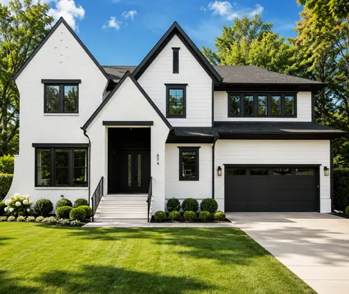
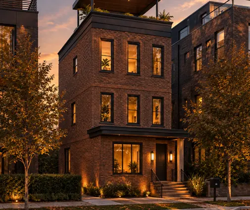
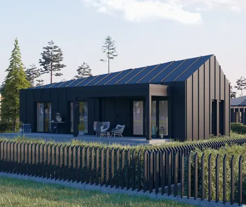
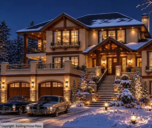
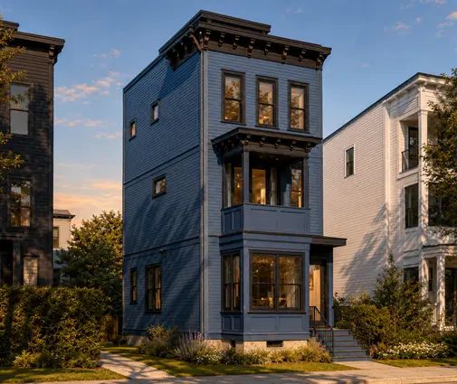
Once setbacks are drawn, many waterfront and ravine lots leave a narrow or irregular buildable area. A wide one-storey plan such as this 3-bedroom modern farmhouse bungalow of 2168 sq ft suits a generous suburban lot, but it may not fit between a top-of-slope setback and a front-yard setback. Going up is often the answer. A 3-storey modern plan with 3 bedrooms and 2509 sq ft or a 3-storey Craftsman with 4 bedrooms in 2238 sq ft gives a family home on a much smaller footprint, and it keeps more of the lot as yard and natural buffer.
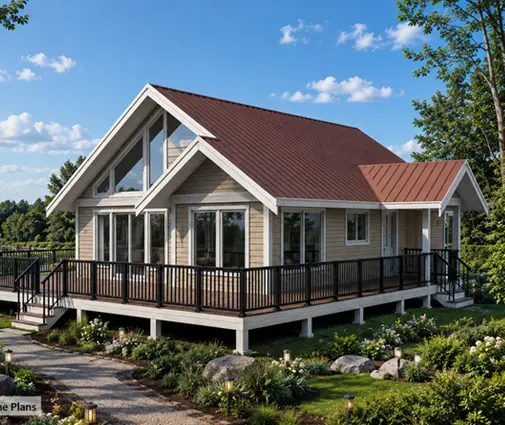
On a tight recreational property, a smaller plan can be the difference between approval and redesign. This 975 sq ft lake cottage with 2 bedrooms on one level fits where a larger plan will not. For very narrow envelopes, a 4-storey, 1700 sq ft plan with 3 bedrooms and no garage shows how far a compact footprint can go. Browsing narrow lot house plans is a good way to start once you know your envelope width.


7. Match the foundation to the hazard
A full basement is the default in most of Ontario because of frost depth, but in a flood fringe it can be restricted or ruled out. Conservation authorities often require all habitable floors, mechanical equipment and openings to sit above the regulatory flood elevation. In that case, a slab-on-grade with frost-protected footings, a crawlspace, or a raised main floor may be the approved solution. Bring the flood elevation to your designer early so floor heights are set before the drawings are finished.
On ravine lots, the slope itself can work for you, as long as the house stays behind the stable top of slope and the drainage is managed. A walkout basement facing the valley is a classic Ontario answer. This 1603 sq ft modern bungalow with 3 bedrooms and a basement keeps the footprint modest, and this 3-storey mountain-style plan with 4 bedrooms, 2519 sq ft and a basement is built for grade changes. The sloped lot plans collection has more options. Whatever you choose, expect the conservation authority and your geotechnical engineer to look closely at roof and foundation drainage, since water directed toward a slope can undermine it.

Before you commit
The order matters: confirm whether the lot is regulated, map the real building envelope, find out which studies are needed, and only then lock in a plan and a foundation type. Rules, maps and fees change, and each conservation authority applies the provincial regulation through its own policies. Check the current requirements with your conservation authority, your municipal building department and an Ontario designer or architect before you buy or build. Done in that order, a lot on the water or the edge of a ravine can still be a great place for a family home.